Victoria Falls
The world's largest sheet of falling water.
Place overview
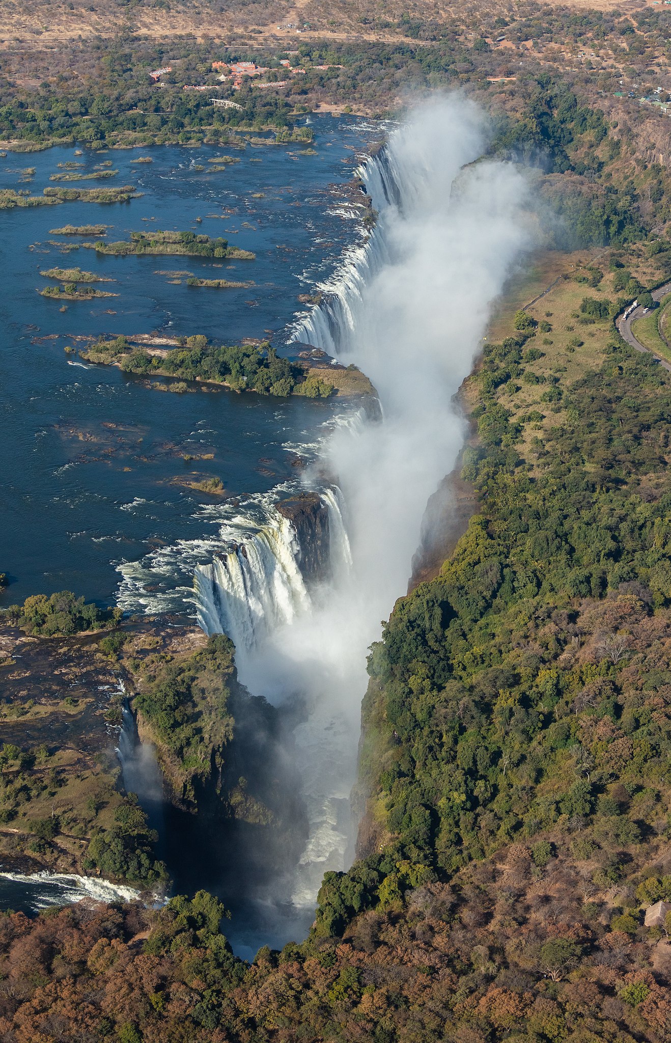
Victoria Falls (Lozi: Mosi-oa-Tunya, "Thundering Smoke"; Tonga: Shungu Namutitima, "Boiling Water") is a waterfall on the Zambezi River, located on the border between Zambia and Zimbabwe. It is one of the world's largest waterfalls, with a width of 1,708 m (5,604 ft). The region around it is inhabited by several species of plants and animals.
Archaeology and oral history describe a long record of African knowledge of the site. Although known to some European geographers before the 19th century, Scottish missionary David Livingstone identified the falls in 1855, naming them Victoria Falls after Queen Victoria. Since the mid-20th century, the site has been a major tourist destination. Zambia and Zimbabwe both have national parks and tourism infrastructure at the site. Research in the late 2010s found that precipitation variability due to climate change is likely to alter the character of the falls.
David Livingstone was the first European recorded to have viewed the falls on 16 November 1855, from an island now known as Livingstone Island, one of two land masses in the middle of the river, immediately upstream from the falls near the Zambian shore. Livingstone named his sighting in honour of Queen Victoria, but the Sotho language name, Mosi-oa-Tunya—"The Smoke That Thunders"—continues in common usage. The World Heritage List officially recognises both names. Livingstone also cited an older name, Seongo or Chongwe, which means "The Place of the Rainbow", as a result of the constant spray.
Learn more about Victoria FallsView places in the same countries
Gallery
View the source gallery here: Victoria Falls Wikimedia