Uluru
A 300 meters tall sandstone monolith considered sacred to aboriginals.
Place overview
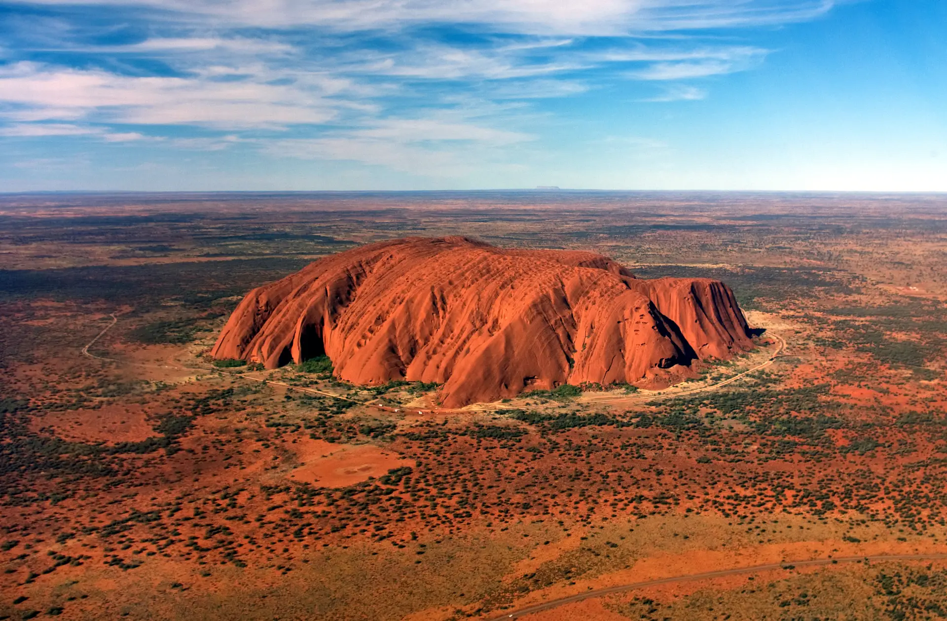
Uluru also known as Ayers Rock, is a large sandstone monolith. It outcrops near the centre of Australia in the southern part of the Northern Territory.
The sandstone formation stands 348 m (1,142 ft) high, rising 863 m (2,831 ft) above sea level with most of its bulk lying underground, and has a total perimeter of 9.4 km (5.8 mi). Uluru is notable for appearing to change colour at different times of the day and year, most notably when it glows red at dawn and sunset. The reddish colour in the rock derives from iron oxide in the sandstone.
Uluru is sacred to the Pitjantjatjara, the Aboriginal people of the area, known as the Aṉangu. The area around the formation is home to an abundance of springs, waterholes, rock caves and ancient paintings. Uluru is listed as a UNESCO World Heritage Site. Uluru and Kata Tjuta, also known as the Olgas, are the two major features of the Uluṟu-Kata Tjuṯa National Park.
Uluru is one of Australia's most recognisable natural landmarks and has been a popular destination for tourists since the late 1930s. It is also one of the most important indigenous sites in Australia.
Learn more about UluruView places in the same country
Gallery
View the source gallery here: Uluru Wikimedia