Towers of Paine
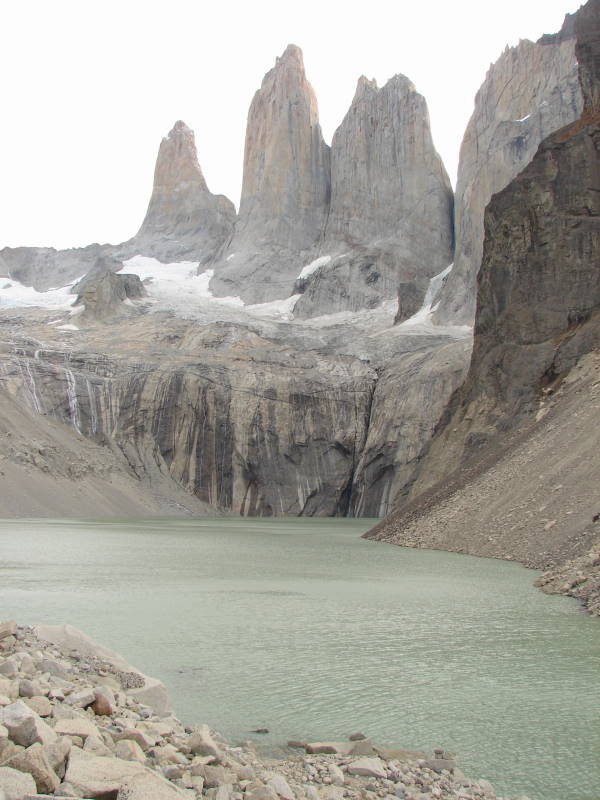
Three distinct granite peaks in the Paine mountain range.
Place overview
Torres del Paine National Park (Spanish: Parque Nacional Torres del Paine) is a national park encompassing mountains, glaciers, lakes, and rivers in southern Chilean Patagonia. The Cordillera del Paine is the centerpiece of the park. It lies in a transition area between the Magellanic subpolar forests and the Patagonian Steppes. The park is located 112 km (70 mi) north of Puerto Natales and 312 km (194 mi) north of Punta Arenas. The park borders Bernardo O'Higgins National Park to the west and the Los Glaciares National Park to the north in Argentine territory. Paine means "blue" in the native Tehuelche (Aonikenk) language and is pronounced PIE-neh. It was established as a National Park in 1959.
Torres del Paine National Park is part of the Sistema Nacional de Áreas Silvestres Protegidas del Estado de Chile (National System of Protected Forested Areas of Chile). In 2013, it measured approximately 181,414 hectares (700 sq mi). It is one of the largest and most visited parks in Chile. The park averages around 252,000 visitors a year, of which 54% are foreign tourists, who come from many countries all over the world. It is also part of the End of the World Route, a tourist scenic route.
The park is one of the 11 protected areas of the Magallanes Region and Chilean Antarctica (together with four national parks, three national reserves, and three national monuments). Together, the protected forested areas comprise about 51% of the land of the region (6,728,744 hectares (25,980 sq mi)).
Learn more about Towers of PaineView places in the same country
Gallery
View the source gallery here: Towers of Paine Wikimedia