Tatacoa Desert
.
Place overview
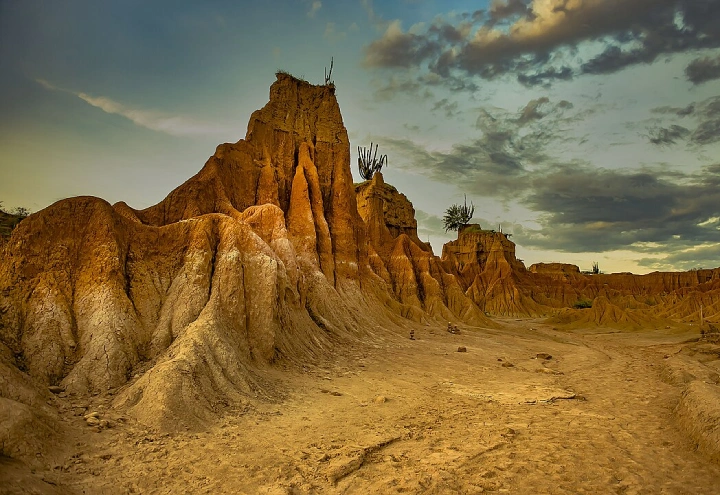
The Tatacoa Desert is the second largest arid zone in Colombia after the Guajira Peninsula. It occupies more than 330 square kilometers. This region is located north of Huila Department, 38 km from the city of Neiva and 15 km (9 mi) from Natagaima in Tolima. It is renowned as a rich deposit of fossils and a tourist destination. The Tatacoa Desert has two distinctive colors: ochre in the area of Cuzco and gray in the Los Hoyos area.
The Tatacoa, or the Valley of Sorrows, as it was called in 1538 by the conquistador Gonzalo Jiménez de Quesada, is not a barren desert but rather a tropical dry forest. The name "Tatacoa", also given by the Spanish, refers to its rattlesnakes. During the Tertiary Period, it was wetter, with thousands of flowers and trees, but has been gradually drying up to become an arid zone.
The Tatacoa covers 330 square kilometers around the town of Villavieja. The area is heavily eroded and crossed by dry canyons that develop transiently in the winter months. These shapes are created on clay surfaces, creating labyrinthine gullies.
Learn more about Tatacoa DesertView places in the same country
Gallery
View the source gallery here: Tatacoa Desert Wikimedia