Nullarbor Cliffs
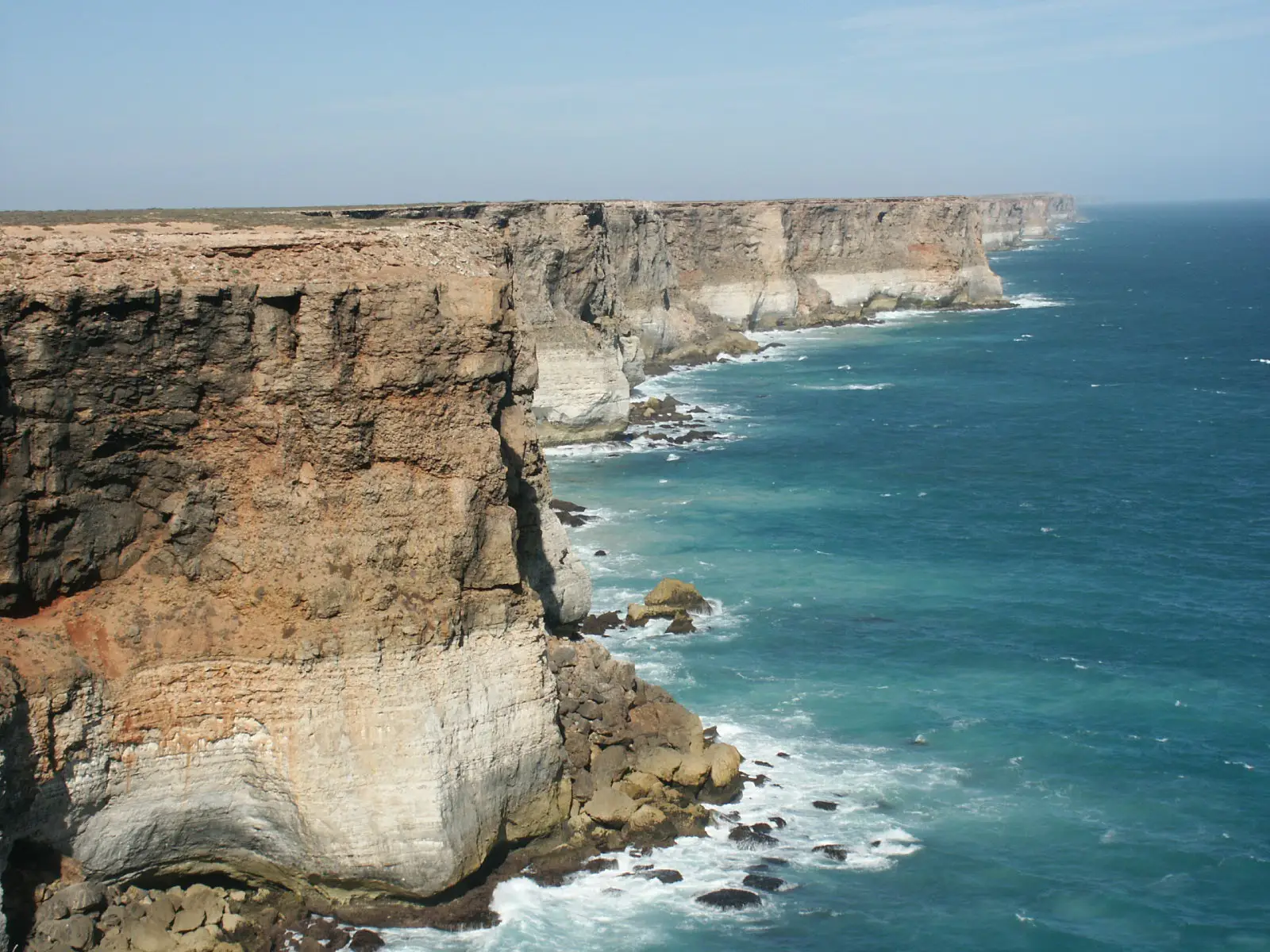
210 km of coastline featuring rocky cliffs towering 60 meters in height.
Place overview
The Bunda Cliffs, also known as the Nullarbor Cliffs, are a coastal scarp on the southern coast of Australia, extending from the western coast of South Australia to the south-eastern corner of Western Australia.
The Bunda Cliffs extend for 210 kilometres along the shore of the Great Australian Bight near its northern extremity. The cliffs extend from Head of the Bight in the east to Eucla, Western Australia in the west. There are some local cliff-line breaks towards the eastern and western ends, with a 160 kilometres uninterrupted cliff line from near the eastern end to a point 28km west of the South Australia–Western Australia border.
The cliffs are bounded on the north by the arid Nullarbor Plain, in a very sparsely settled area of Australia. The cliffs, which are some 60–120 metres in height, can be viewed from several viewing points along the Eyre Highway east of Eucla and west of Nullarbor roadhouse.
Learn more about Nullarbor CliffsPlace location
Click the following link to view in maps: Nullarbor Cliffs Maps
We don't have the coordinates for this place.
View in MapsView places in the same country
Gallery
View the source gallery here: Nullarbor Cliffs Wikimedia