Kata Tjuta
Large extension of dome-shaped rock formations.
Place overview
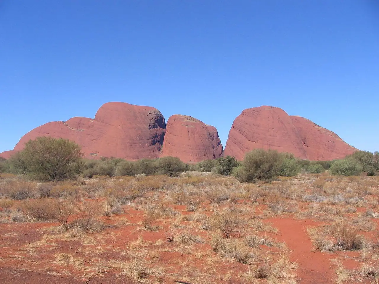
Kata Tjuṯa, also known as The Olgas is a group of large, domed rock formations or bornhardts located in central Australia.
Alongside Uluṟu / Ayers Rock to the east, they form the two major landmarks within the Uluṟu-Kata Tjuṯa National Park. The park is considered sacred to the local Aboriginal community, and in their language, it's name means 'many heads'.
The 36 domes that make up Kata Tjuṯa / Mount Olga cover an area of 21.68 km are composed of conglomerate, a sedimentary rock consisting of cobbles and boulders of varying rock types including granite and basalt, cemented by a matrix of coarse sandstone. The highest dome, Mount Olga, is 1,066 m above sea level, or approximately 546 m above the surrounding plain (198 m higher than Uluṟu).
Kata Tjuta, in the Pitjantjatjara dialect, is the traditional Aboriginal name for the formation. The alternative name, The Olgas, comes from the tallest peak, Mount Olga. At the behest of Baron Ferdinand von Mueller, Mount Olga was named in 1872 by Ernest Giles, in honour of Queen Olga of Württemberg (born Grand Duchess Olga of Russia, daughter of Tsar Nicholas I).
Learn more about Kata TjutaView places in the same country
Gallery
View the source gallery here: Kata Tjuta Wikimedia