Glacier Bay
One of the best landscapes in the world to observe the creation of icebergs.
Place overview
Glacier Bay National Park and Preserve is an national park of the United States located in Southeast Alaska west of Juneau. President Calvin Coolidge proclaimed the area around Glacier Bay a national monument under the Antiquities Act on February 26, 1925. Subsequent to an expansion of the monument by President Jimmy Carter in 1978, the Alaska National Interest Lands Conservation Act (ANILCA) enlarged the national monument by 523,000 acres (817.2 sq mi; 2,116.5 km) on December 2, 1980, and created Glacier Bay National Park and Preserve. The national preserve encompasses 58,406 acres (91.3 sq mi; 236.4 km) of public land to the immediate northwest of the park, protecting a portion of the Alsek River with its fish and wildlife habitats, while allowing sport hunting.
Glacier Bay became part of a binational UNESCO World Heritage Site in 1979, and was inscribed as a Biosphere Reserve in 1986. The National Park Service undertook an obligation to work with Hoonah and Yakutat Tlingit Native American organizations in the management of the protected area in 1994. The park and preserve cover a total of 3,223,384 acres (5,037 sq mi; 13,045 km), with 2,770,000 acres (4,328 sq mi; 11,210 km) being designated as a wilderness area.
The west side of the bay consists of a 26,000 feet thick sequence of Paleozoic sedimentary rocks, mainly massive limestones and argillite. The oldest rocks in this sequence are the Late Silurian Willoughby limestone and the youngest being the Middle Devonian Black Cap limestone. An outcrop west of Tidal Inlet includes a sandstone, graywacke and limestone of unknown age. Sedimentary rocks of unknown age on the east side of Muir Inlet include tuff interbedded with limestone. The rocks exposed on the 1,205 foot high hill called "The Nunatak" have been metamorphosed. Early Cretaceous diorite stocks are exposed south of Tidal Inlet, and on Sebree and Sturgress Islands. Quartz diorite outcrops on Lemesurier Island. A granitic stock is exposed in Dundas Bay. Mafic dikes up to 20 feet in width occur throughout the area.
Learn more about Glacier BayView places in the same country
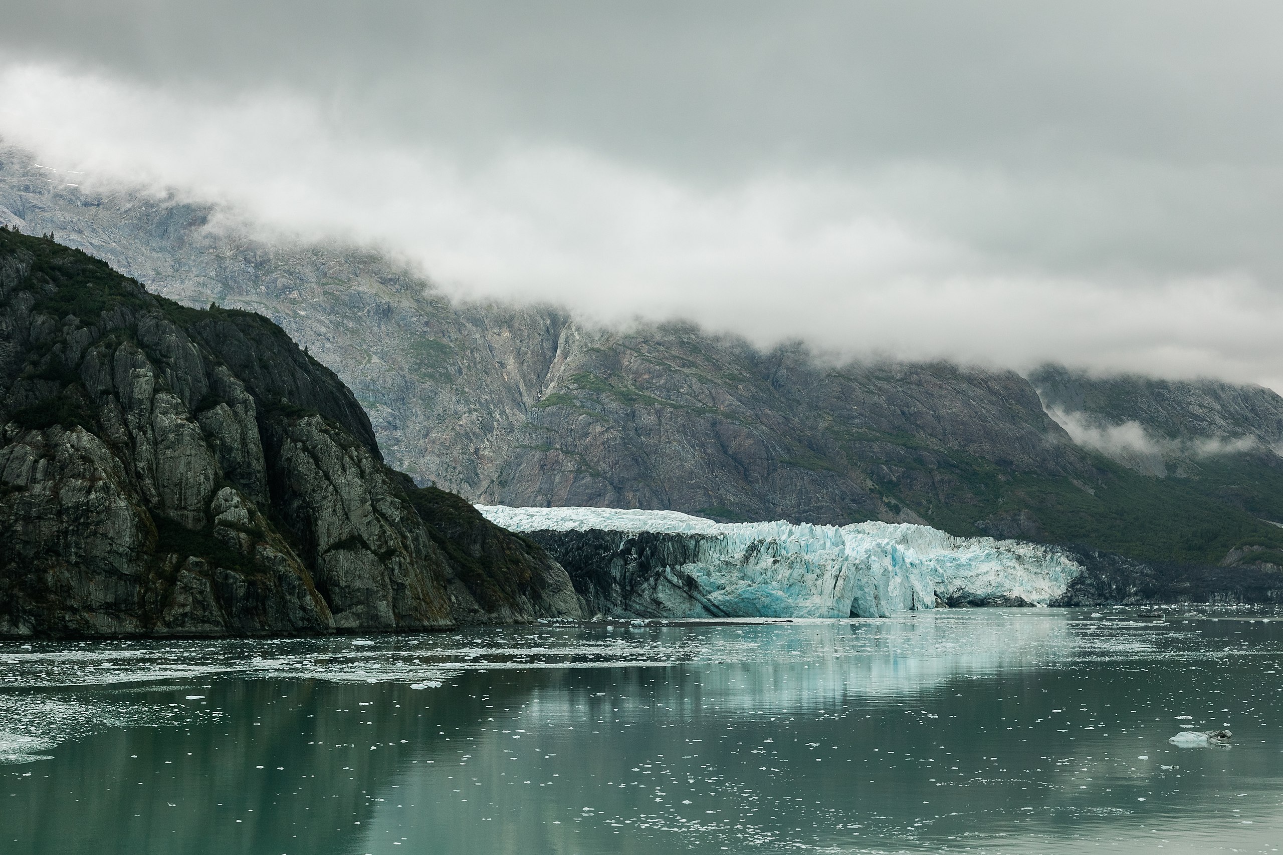
Gallery
View the source gallery here: Glacier Bay Wikimedia