Cliffs of Moher
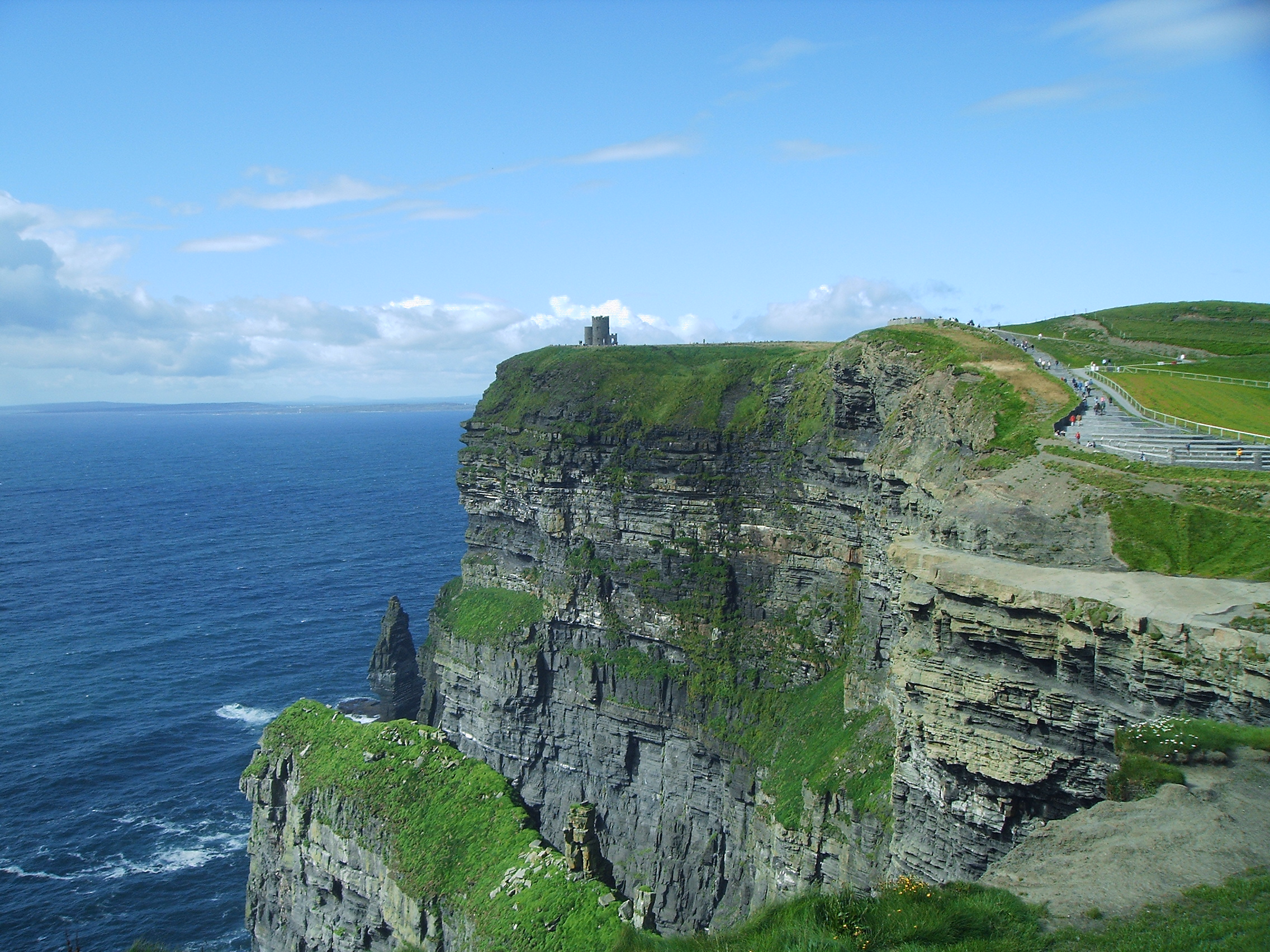
14Km long sea cliffs towering up to 214 meters above the atlantic ocean.
Place overview
The Cliffs of Moher (; Irish: Aillte an Mhothair) are sea cliffs located at the southwestern edge of the Burren region in County Clare, Ireland. They run for about 14 kilometres (9 miles). At their southern end, they rise 120 metres (390 ft) above the Atlantic Ocean at Hag's Head, and, 8 kilometres (5 miles) to the north, they reach their maximum height of 214 metres (702 ft) just north of O'Brien's Tower, a round stone tower near the midpoint of the cliffs, built in 1835 by Sir Cornelius O'Brien, then continue at lower heights. The closest settlements are the villages of Liscannor 6 km (4 miles) to the south, and Doolin 7 km (4 miles) to the north.
From the cliffs, and from atop the tower, visitors can see the Aran Islands in Galway Bay, the Maumturks and Twelve Pins mountain ranges to the north in County Galway, and Loop Head to the south. The cliffs rank among the most visited tourist sites in Ireland, with around 1.5 million visits per year.
The cliffs take their name from an old promontory fort called Mothar or Moher, which once stood on Hag's Head, the southernmost point of the cliffed coast, now the site of Moher Tower. The writer Thomas Johnson Westropp referred to it in 1905 as Moher Uí Ruis or Moher Uí Ruidhin. The fort still stood in 1780 and is mentioned in an account from John Lloyd's A Short Tour of Clare (1780). It was demolished in 1808 to provide material for a lookout/telegraph tower that was intended to provide warning in case of a French invasion during the Napoleonic wars.
Learn more about Cliffs of MoherView places in the same country
Gallery
View the source gallery here: Cliffs of Moher Wikimedia