Chocolate Hills
.
Place overview
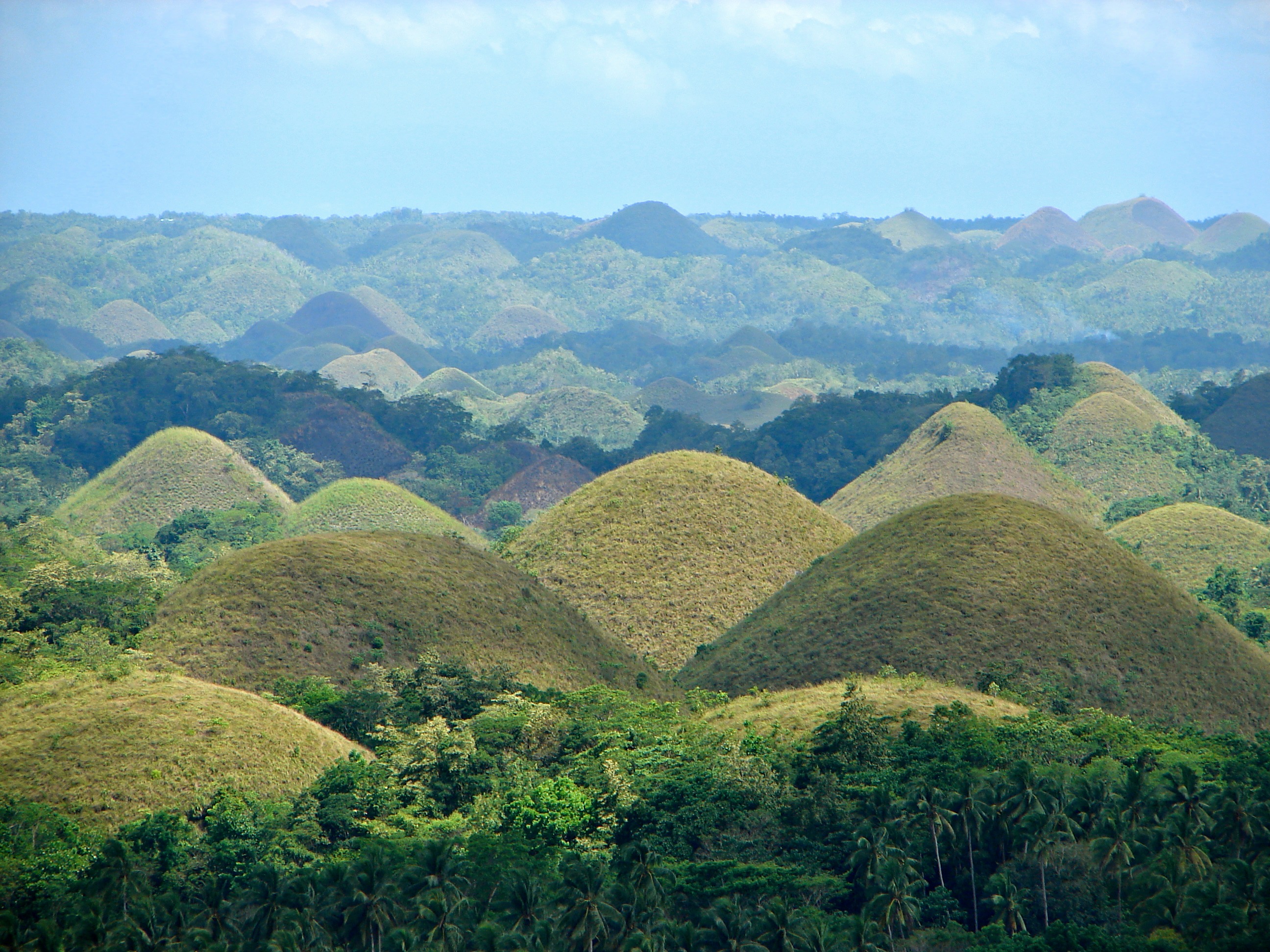
The Chocolate Hills (Cebuano: Mga Bungtod sa Tsokolate, Filipino: Mga Tsokolateng Burol, or Mga Burol na Tsokolate) are a geological formation in the Philippine province of Bohol. There is a minimum of 1,260 hills and possibly up to 1,776, spread over an area of more than 50 square kilometers (20 sq mi). They are covered in green grass that turns a chocolate-brown during the dry season, hence the name.
The Chocolate Hills are featured on the provincial flag and seal to symbolize the abundance of natural attractions in the province. The site is on the Philippine Tourism Authority's list of tourist destinations in the Philippines, and it has been declared the country's third national geological monument, as well as being proposed for inclusion in UNESCO's World Heritage List.
The Chocolate Hills form a rolling terrain of haycock-shaped hills—mounds of a generally conical and almost symmetrical shape. With an estimated 1,268 to 1,776 individual mounds, these dome-shaped hills are actually made of grass-covered limestone. The domes vary in size from 30 to 50 meters (98 to 164 ft) high, with the largest being 120 meters (390 ft) in height. One of Bohol's best-known tourist attractions, these unique hills are scattered by the hundreds throughout the towns of Carmen, Batuan, and Sagbayan.
Learn more about Chocolate HillsView places in the same country
Gallery
View the source gallery here: Chocolate Hills Wikimedia