Chapada Diamantina
Expansive plateau famed for its dramatic cliffs, waterfalls, and diverse ecosystems.
Place overview
Chapada Diamantina (; Portuguese for the "Diamond Plateau") is a region of Bahia state, in the Northeast of Brazil. This mountain range is known as "Serra do Espinhaço", in Minas Gerais state, south of Bahia.
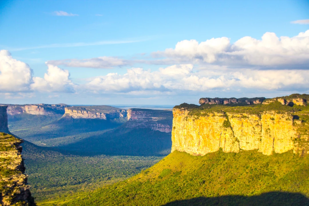
The Chapada Diamantina lies at the center of Bahia State and forms the northern part of the Espinhaço Mountain Range. The region is approximately 38,000 km (15,000 sq mi) in area and encompasses 58 municipalities. Technically, this region is considered a part of the caatinga biome, and contains some of its highest elevations, most of it above 500 metres (1,600 ft). The vegetation; a product of the physiographic conditions, is known as cerrado, and consists of rocky plains, dry forests, and caatinga desert vegetation, all of which harbour a great deal of biodiversity and unique endemisms. The region is considered to have a Mesotermic climate, of the Cwb type, according to Köppen Climate classifications. It is normally quite cooler than its surrounding areas, with an average annual temperature under 22 °C. The territory of the Chapada Diamantina runs roughly between the cities of Mucugê (13°00′S 41°22′W / 13.000°S 41.367°W / -13.000; -41.367) to the south, Andaraí (12°48′S 41°20′W / 12.800°S 41.333°W / -12.800; -41.333) in the southeast, Lençóis (12°33′S 41°23′W / 12.550°S 41.383°W / -12.550; -41.383) in the northeast, and Palmeiras (12°31′S 41°35′W / 12.517°S 41.583°W / -12.517; -41.583) in the northwest. This region is named the Serra do Sincorá Ridge. However, the city of Ibicoara, near the southern limits of Chapada Diamantina, is also becoming important. The Sincorá Ridge is North–South oriented and has a length of 160 km and 20 to 30 km of width.
It has huge canyons with rivers of brownish waters and several waterfalls. The high altitude grasslands are known locally as Gerais. The trails were once used by miners in their search for diamonds. From Lençóis, one of the most important cities in the area, one can find quite a few ecotourism agencies as well as independent guides. Among the main attractions are the Morro do Pai Inácio (Pai Inácio Hill), Cachoeira da Fumaça, Mixila Waterfall, Sossego Waterfall and the Vale do Pati which is considered the best trekking destination in the country. Rock climbing is a relatively new activity, but is developing quickly as some local and outside climbers are opening more and more routes, mainly in the city of Lençóis and at Vale do Capão, district of Palmeiras and at Igatu, district of Andaraí. Lençóis, one of the main cities, is 428 kilometres (266 miles) from Salvador and can be reached by car, bus or plane. Another important city is Iraquara. It has a lot of caves, where prehistoric rock art and other evidence of early human habitation can be found. For this reason, Iraquara received the nickname "City of Caves".
Learn more about Chapada DiamantinaPlace location
Click the following link to view in maps: Chapada Diamantina Maps
We don't have the coordinates for this place.
View in MapsView places in the same country
Gallery
View the source gallery here: Chapada Diamantina Wikimedia