Bryce Point
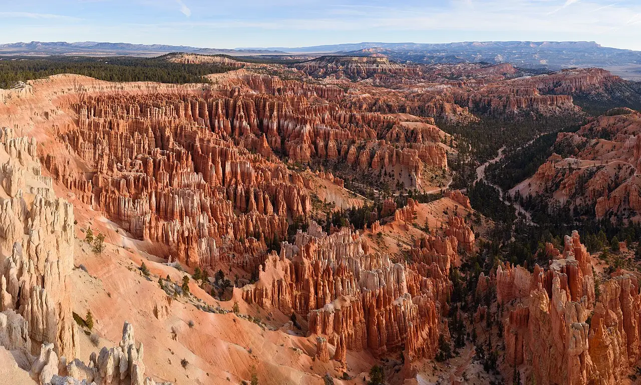
Incredible vistas of "hoodoo" rock formations.
Place overview
Bryce Point is a location within Bryce Canyon National Park. It's a collection of natural amphiteaters full of hoodoo (or fairy chimney) rock formations, some of which reach 60m in height, due to frost weathering and erosion from the river and lake bed sediments.
The red, orange, and white colors of the rocks provide spectacular views for park visitors. Bryce Canyon National Park is much smaller and sits at a much higher elevation than nearby Zion National Park. The rim at Bryce varies from 8,000 to 9,000 feet (2,400 to 2,700 m).
The Bryce Canyon area was settled by Mormon pioneers in the 1850s and was named after Ebenezer Bryce, who homesteaded in the area in 1874. The area was originally designated as a national monument by President Warren G. Harding in 1923 and was redesignated as a national park by Congress in 1928.
The park covers 35,835 acres (55.992 sq mi; 14,502 ha; 145.02 km) and receives substantially fewer visitors than Zion National Park (nearly 4.3 million in 2016) or Grand Canyon National Park (almost 6 million in 2016), largely due to Bryce's more remote location. In 2023, Bryce Canyon received 2,461,269.
Learn more about Bryce PointView places in the same country
Gallery
View the source gallery here: Bryce Point Wikimedia